
2010 Aerial shows existing conditions and current water levels.
Our cabin is located on the top of the hill in the clearing on the west side of the map. You can see its green roof. In addition along the lake you can see Jay/Deanne's, Gary/Ginny, Kohane's as well as Ben/Becky's old cabin.

1998 Color IR image shows historic conditions and water levels 13 years ago.
When viewing CIR imagery green is represented as red. The 98 aerial was taken during the leaf off time so the aerial really shows off the conifers in the area. Alders are also easily seen as the lighter shade of black w/ the lake be the darkest shade of black.

1992 Aerial and Water Level

1998 Aerial and Water Level

2005 Aerial and Water Level

2009 Aerial and Water Level

2010 Aerial and Water Level
When comparing surface water area between 1998 (yellow boundary repesenting the maximum water levels) and 2010 (Red Boundary representing the miniumum water levels) aerial photos there is about a -20.5% loss of surface water area between the two time stamps. I would estimate the average water depth to be about -8 FT. So one can assume an average depth of -4 FT and multiply this by the change in surface area to estimates changes in water level:
Change in Surface Area -5.10 Acres
Pct Change over 25 Yrs -20.50%
Change in Volume: -884653.19 Cubic Feet
Change in Volume: 20.3 Acre-Feet
Change in Volume: 20.3 Acre-Feet
One might hypothesize that water levels on the lake might be mainly be controled by precipation and the amount of water available in the form of rain, snow and runoff. Because the contributing drainage area is relatively small (see detailed drainage divides map below) and the lake is situated very close to a major watershed divde between the Sturgeon River and the Ontanogon River I chose not to plot out runoff as I suspect this to be a minor contriubutor.
With this in mind I have compiled historic precipitation records going back to 1930. The easiest and cheapest way I could figure out how to do this was to run an ArcSWAT model for annual flow and then summarize precipitation records. Combined w/ the historic precipiation records I also compiled the historic surface water acreages and plotted them on the graph below.

The graph above shows a pretty strong correlation between rainfall (blue line on top of chart) and lake surface area (blocks overlaid on the rainfall chart above). The strongest relationship I could find was w/ a 5-yr moving average which is deplayed as a best fit line on the top chart. The one outlier to that does not support this trend is in 1992. I suspect this doesn't align w/ the others b/c of the large range in rainfall totals between 1991 and 1992. In addition the aerial imagery in 1992 was acquired in the spring so it may not reprensent the timing of the precipation which occurred in 1992 with peak rainfall typically occuring in Aug/Sept which would be well after the imagery was collected.
Here are a number of other interesting maps that may also be contributing variables to the changing water levels.
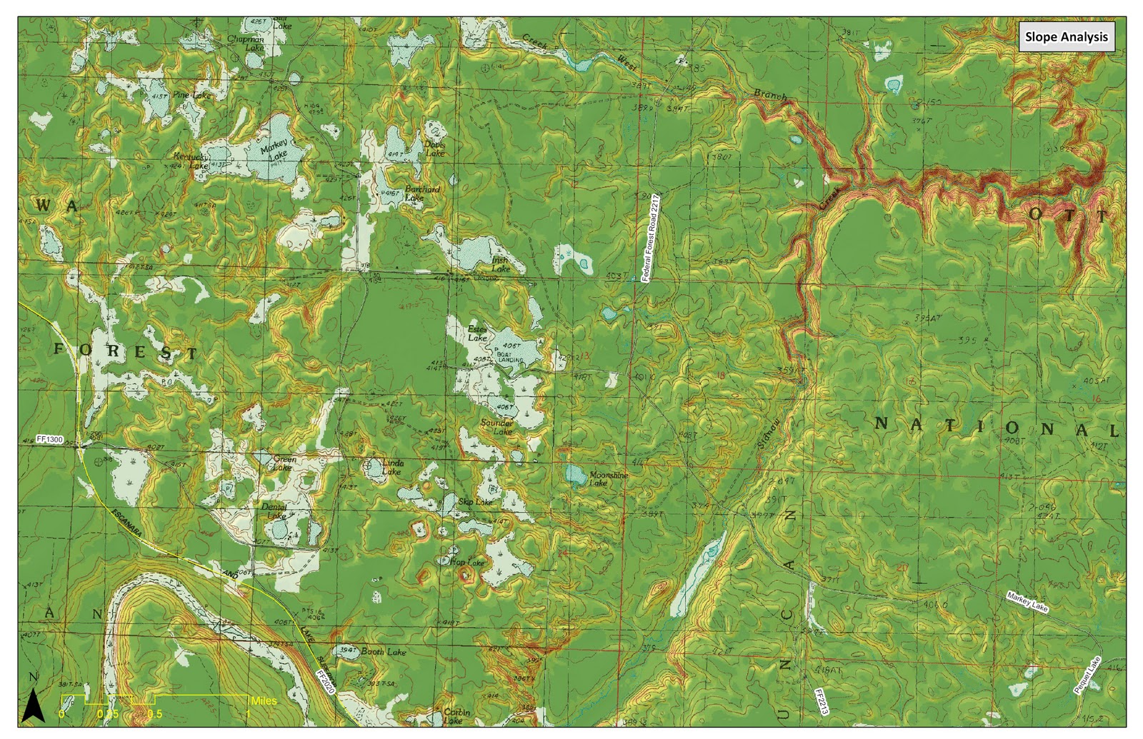
Regional slopes and topography for the area. Red areas have the most topographic change while green areas are flatter or having less relief.

Using 10m digital elevation model (DEM) detailed drainages lines and drainage areas were delineated to better understand surface water drainage patterns.
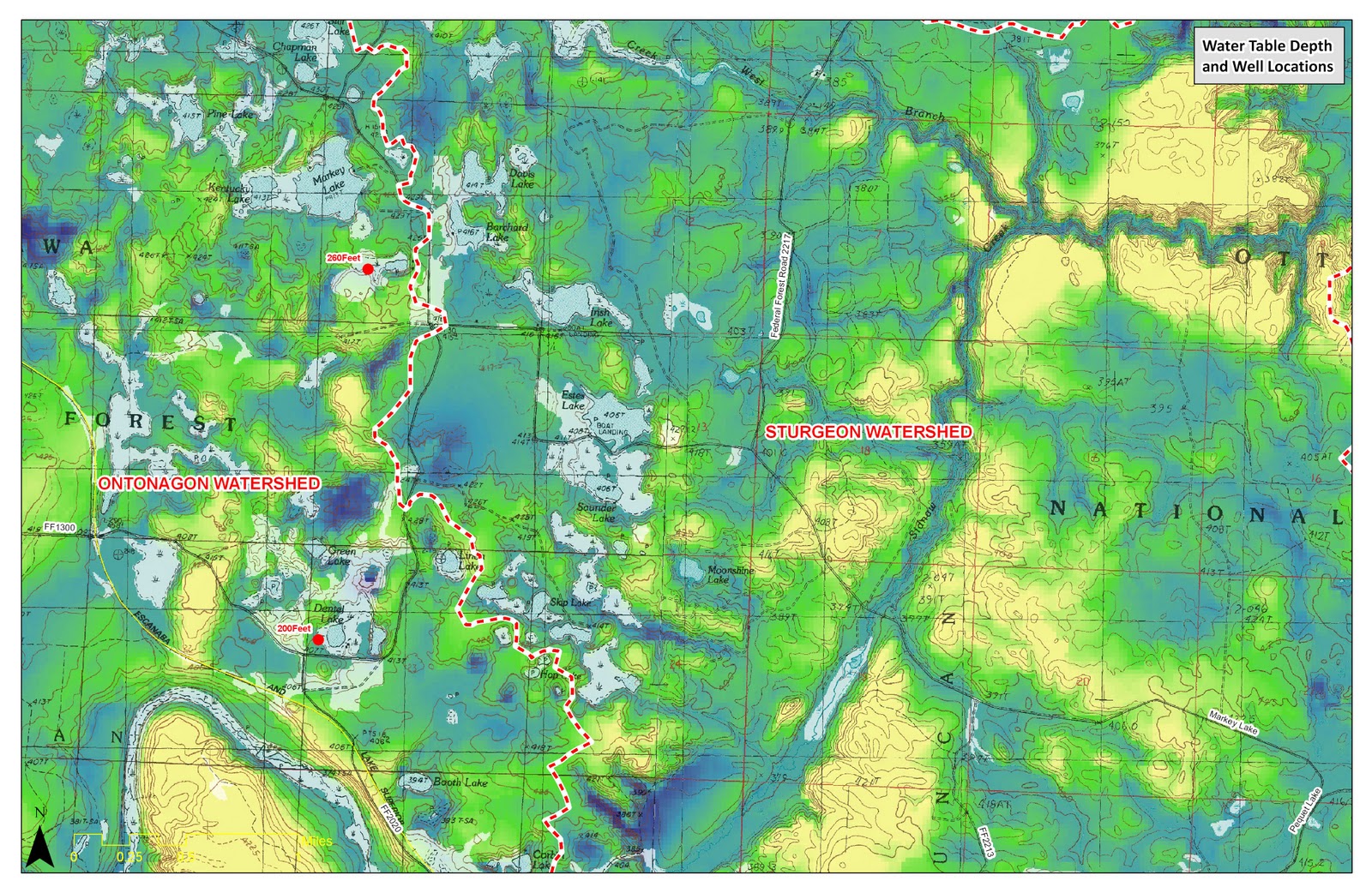
Map shows drinking wells that have been drilled in the area, their associated depth to groundwater as well as a surface showing depths to groundwater. Difference between surface topography and ground water depth. Blue areas show less depth to groundwater, while yellow areas show greater depth to groundwater. The maps is missing one known well that was drilled about 100 yards west of Este Lake.

Potential impacts or ground water drawn down as a result of drinking wells are shown on map above (Brown shading represents ground water dwaw down: Darker the brown the more draw down potential exists). Also shown on this map are detailed drainage boundaries and aquifer locations. Based upon the season use of these wells it is not likely wells would have any impact on the lakes water level.
